Surface Deformation (Persistent Scatterer SAR Interferometry)
Currently we use Radar interferometry, including traditional DInSAR and PSI to study the recent surface deformation around the island of Taiwan. We also employ GPS and leveling to assess more precise point data.
DInSAR - Differential Interferometric SAR
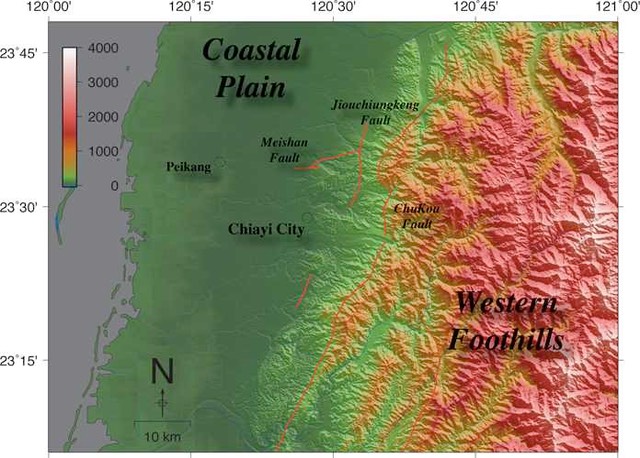
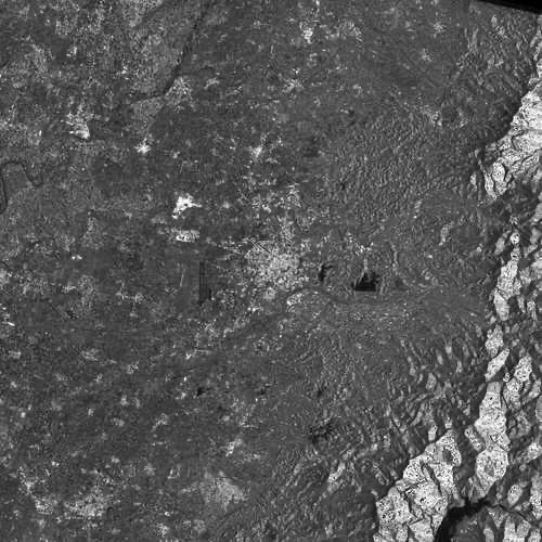
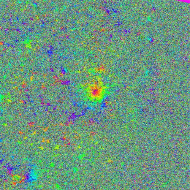
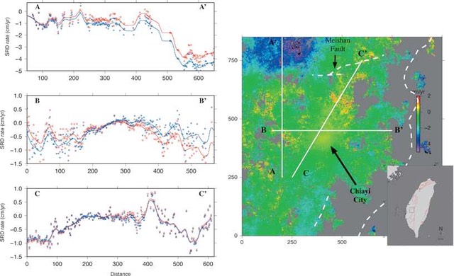
利用DInSAR觀察嘉義市附近地表變形(文章發表於Remote Sensing of Environment <doi:10.1016/j.rse.2007.06.012>)
Deformation around Chiay City (Article published in Remote Sensing of Environment <doi:10.1016/j.rse.2007.06.012>)
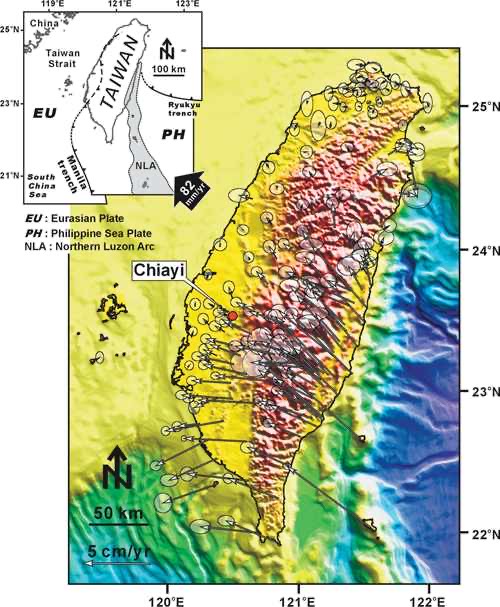
Figure 1. Tectonicsetting and velocity field of Taiwan. Philippine Sea plate is moving toward the Eurasian plate at about 82 mm/yr, creating a large compressive stress regime in the island of Taiwan. The stress is partitioned throughout the entire island as can be seen from the GPS velocity field. (GPS data after Yu et al., 1997)
GPS
Prof. Yo-Ho Chang is leading the geodetic team to measure the surface deformation around Hualien.
PSI (Persistent Scatterer SAR Interferometry)
PSI (永久散射體差分干涉)
PSInSAR was a technique developed to investigate surface deformation while minimize possible errors (from uncertainties and inaccuracy of digital elevation model and atmospheric conditions), It is especially great in investigating large rural area. The idea of using stable points rather than entire radar images was not new, but the current incarnation of PSInSAR was mainly developed by Italian scholar A. Ferretti, and later further developed by many others.
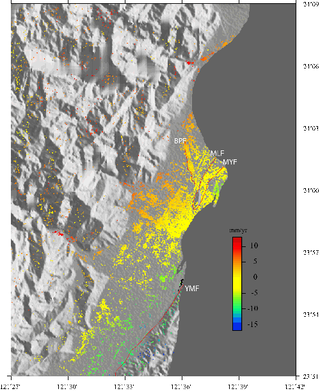
Hualien city is located at the northern end of collisional boundary between Eurasian plate and Philippine sea plate.
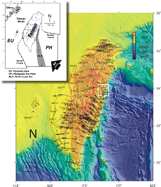
Figure 1. Study area and tectonic features near Taiwan
Hualien city looks like this. The small urban area was surrounded by farms, rivers, and mountains. The high precipitation in Hualien easily wiped out surface expressions of neotectonic deformation. Therefore, an effective way of monitoring surface deformation, such as PSInSAR, is needed.
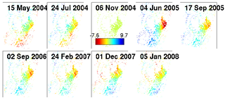
Figure 2. Surface deformation revealed by PSInSAR
Sediment sources and transport
Modal analysis of sediments and sedimentary rocks enable us to trace the sources of the rocks and its dispersal paths.
Raman spectroscopy of carbonaceous materials in Silisiclastic conglomerates in northern Coastal Range of Taiwan
We are currently working on utilizing RSCM method to probe the metamorphic temperatures of the Shuilien conglomerates in the Coastal Range of Taiwan. This is an ongoing project currently under active development.
Surface processes and tectonic geomorphology
Centimeter scale uplift rate and equivalent erosion make Taiwan the best place to study the coupling between tectonics and erosion. Currently we focus on longitudinal river profiles in eastern Taiwan and their tectonic implications.
Tectonic activities of Longitudinal Valley in eastern Taiwan inferred from Fluvial Longitudinal Profiles
Temporal distribution of earthquake slip is one of the most important information for accessing the earthquake hazard. In many cases, ages of past earthquakes can be ob- tained from historical records or excavations of datable materials near active faults. Not all faults have historical records or suitable materials for age-dating, therefore, alterna- tive way of determining timing of fault slip is critically needed. The rapid tectonic activ- ities in the north-south-trending Longitudinal Valley along the eastern Taiwan provides an important opportunity to study the relationship between the collisional mountain building and the spatio-temporal pattern of deformation. However, due to the equally rapid rates of erosion and dense vegetation, geomorphic features related to tectonic activ- ities such as surface fractures and fault scarps can disappear quickly. We exploit digital elevation model (DEM) to look for indications of active tectonics preserved. Specifically, spatial distribution of knickpoints in the eastern flank of the Central Range are used to inferred the tectonic activities in the Longitudinal Valley.