PSI (永久散射體差分干涉)
PSInSAR was a technique developed to investigate surface deformation while minimize possible errors (from uncertainties and inaccuracy of digital elevation model and atmospheric conditions), It is especially great in investigating large rural area. The idea of using stable points rather than entire radar images was not new, but the current incarnation of PSInSAR was mainly developed by Italian scholar A. Ferretti, and later further developed by many others.
Hualien city is located at the northern end of collisional boundary between Eurasian plate and Philippine sea plate.
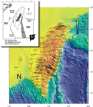
Figure 1. Study area and tectonic features near Taiwan
Hualien city looks like this. The small urban area was surrounded by farms, rivers, and mountains. The high precipitation in Hualien easily wiped out surface expressions of neotectonic deformation. Therefore, an effective way of monitoring surface deformation, such as PSInSAR, is needed.
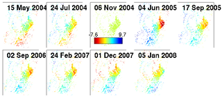
Figure 2. Surface deformation revealed by PSInSAR
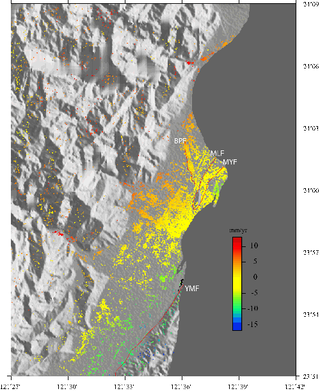
Figure 3. Average velocity
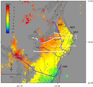
Figure 4. Interpolated velocity field in the study area.