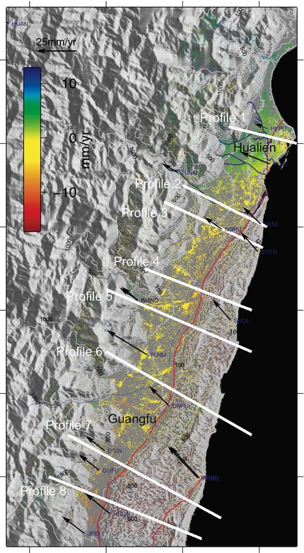
Average surface displacement (relative) along the radar Line-of-Sight between 2004~2008 in the Longitudinal Valley of eastern Taiwan.
The LOS displacement rates was derived from processing satellite radar images acquired by Envisat satellite using Persistent Scatterer technique.